Photogrammetry
How will 3D models help me?
Photogrammetric models are widely used, from precision geodesy to the promotion of tourism facilities and real estate, especially when combined with AR technologies. Using accurate geodetic data, these models allow engineers and urban planners to analyze the terrain in detail, plan infrastructure, and perform precise measurements.
On the other hand, in the tourism industry, photogrammetric models can be used to create virtual tours, interactive maps and AR experiences, which contribute stimulates the enhanced promotion of tourist content and provides visitors with a unique experience of exploring the destination.
With many years of experience and the help of state-of-the-art equipment we have, unmanned aerial vehicles and high-precision RTK modules, we offer a complete service from field trips to processing and publishing data on your or our cloud infrastructure.

Geodesy and cartography
Photogrammetry is used to create precise topographic maps, digital altitude models of terrain, orthophotography and 3D models of terrain.

Architecture and construction
There's no need to go to the field for every measurement when you can do it from the office. Photogrammetry is used to capture existing objects and terrain soils to create 3D models, visualize projects, measure and analyze space, as well as display cross-sectional sections.

Tourism and culture
Photogrammetry is used to create virtual tours, interactive maps, 3D models of monuments, museum exhibits and cultural sites for improved promotion and education of visitors.

Promotion of real estate and hotel accommodation
Photogrammetric models are a great tool to bring your customers closer to how your property or accommodation really looks with the ability to add descriptions or photos to key locations, all of which is available to your client through an internet browser and augmented reality (AR) in one click.

Virtual AR tours
Interactive information: Using augmented reality and only the phone, you can add interactive information to the space, such as prices, descriptions, dimensions or photos that appear in certain places in the property. This helps customers get detailed information about the space as they explore it.

Archaeology
Photogrammetry is used for documentation of archaeological sites, reconstruction and analysis of artifacts, as well as for virtual recreation of lost buildings. Video game and animation industry: Photogrammetry is used to create highly detailed 3D

Click on the button below and see an example of a virtual tour of the facility!
How can I use models?
Depending on the client requirements, use, as well as the precision of the models that can be brought to an incredible value of 1cm, models can be used in numerous professional GIS software for precise analysis as well as simple modules to display to the end user with a few clicks.

Professional GIS
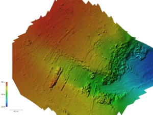
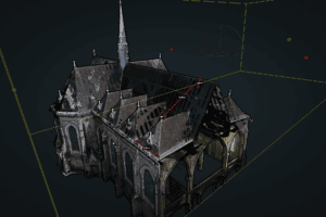
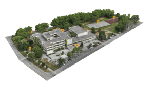
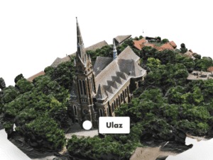
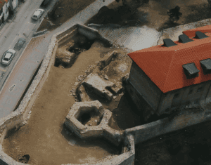
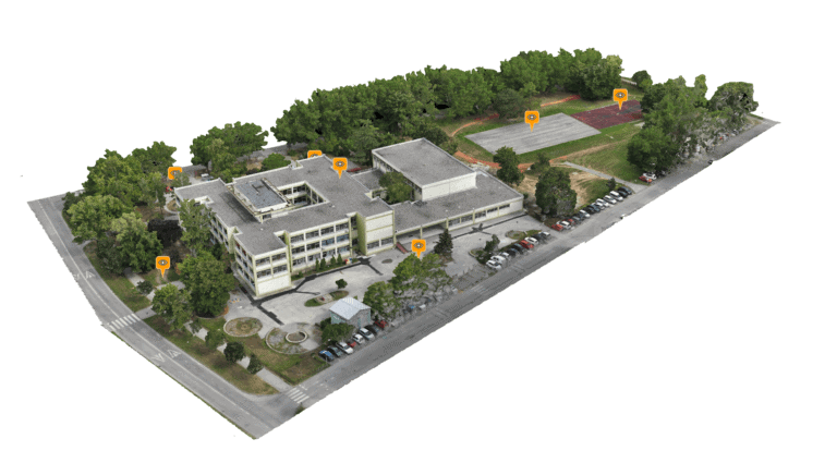
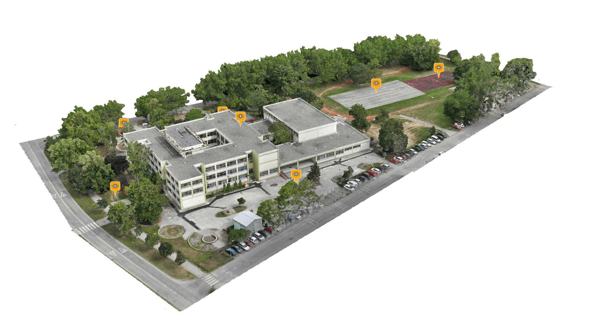
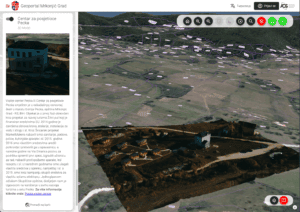
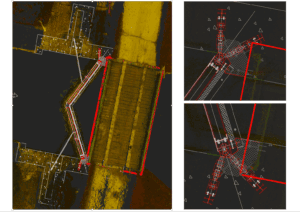
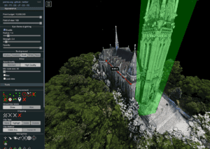
A wide range of formats and data that we can obtain from photogrammetry such as point clouds, mesh models, tiled models, orthophotes, DEM (digital elevation models), etc. enable use and processing through many GIS tools as well as a multitude of precise information, measurements, cross-sections and other parameters that can be obtained from 3D models.

Interactive 3D model on your website
With photogrammetry and its subsequent processing, we can create optimized models for display on your website. With our complete service from going out in the field to processing and publishing data on your website, this model can easily become your advertisement.

QR Codes - AR models optimized for iPhone and Android
If you want your clients to view the models at any time in a very simple and fast way using a mobile phone with only a web browser, they can do so by simply scanning the qr code after which they will be shown the model in augmented reality.

Integration with Geoportal and many other standardized solutions
With a combination of precise photogrammetric imaging and interactive 3D display through our geoportal application, we provide you with a tool that goes beyond classical visualization methods. Your data is becoming dynamic, exploratory tools that allow you to delve deeper into the world of spatial information.

Production of cross sections and construction drawings
Through advanced photogrammetric methods, we provide you with the opportunity to obtain detailed cross-sections of the terrain. These cross-sections provide a deep insight into the characteristics of the terrain and facilities and allow you to make informed decisions when planning and designing.

Web applications for displaying data in high resolution
If your needs require high-resolution display, we have tools that will show you the results without losing quality. Overview of high-resolution 3D models via web browser is becoming an increasingly practical and impressive way to explore complex spatial data and get information without going into the field.
Do you want an interactive 3D model on your website?
Our clients and partners


